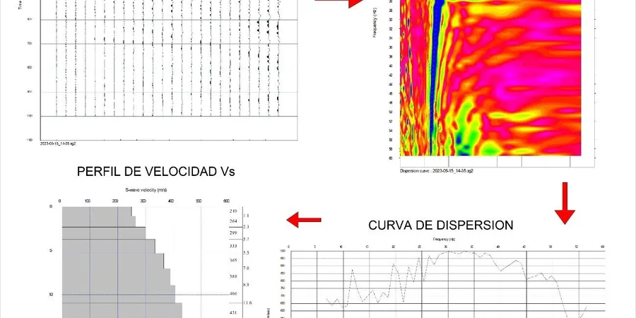
The difference is striking: in Saint-Nicéphore, the glacial till deposits yield moderate shear wave velocities around 350 m/s, while near the Saint-François River, soft alluvial sediments drop below 200 m/s. That contrast drives everything in foundation design and seismic response. A MASW survey across Drummondville captures these velocity profiles without drilling a single hole. We combine surface wave analysis with field verification to map Vs30 values across your site. Before we deploy the geophone array, we often recommend a calicatas exploratorias to correlate surface velocities with actual soil stratigraphy. This integrated approach gives you a reliable base for seismic site classification under NBCC and ASCE 7.
A single MASW line can replace multiple boreholes for seismic classification, saving time and reducing site disturbance in Drummondville.